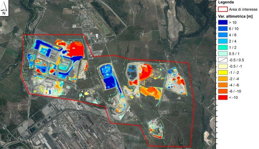
Use of LiDAR (Light Detection and Ranging) data to detect morphological differences and illegals landfills
The research is aimed at detecting illegal landfills, quarries and human activities that move material abnormally.
The current availability of Digital Terrain Models from LiDAR topographic surveys over time allows such analysis, using GIS-based processes.
The development of an automatic procedure allows you to analyse extensive areas and filter the obtained results based on given criteria. The procedure that is suitable for terrain modifications produced by natural and/or anthropic causes is based on the following steps:
- Identification of sites of potential interest;
- Calculation of the differences between DTM grid cell elevation values over time;
- Reclassification of grid-of-terrain differences and conversion into vector files;
Automatic detection of the final site to be considered as potentially illegal, through GIS analysis of the presence of roads access, vicinity to industrial and urban areas, presence of similar sites in the surrounding area.