Analysis of different models to estimate the sediment production at basin scale
The analysis is based on the following:
- Use of different methods to specific case studies, including hydrological software and tools developed in GIS environment;
- Research of the best method in case there’s data scarcity;
- Test and analysis of the most significant parameters;
- Evaluation of the potentiality and limits of different methods.
A case study included the application of MUSLE (Modified USLE method Williams, 1975):
- The hydrological model HEC HMS was implemented for different sub-catchments, based on available data;
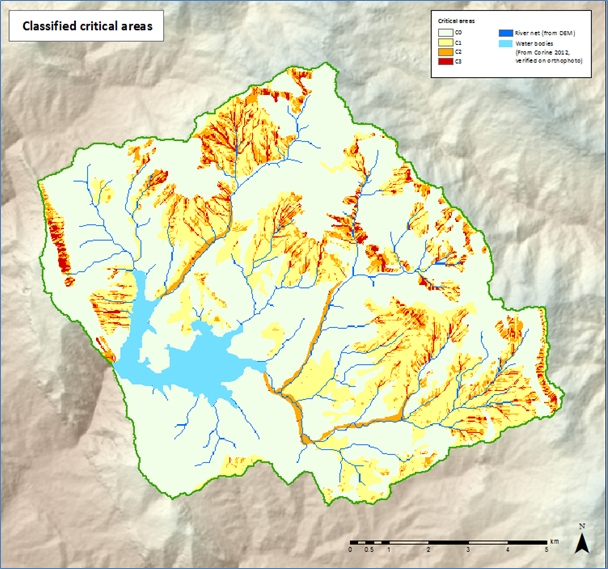
- GIS procedures were developed to analyse the critical areas of the same sub-catchments subject to erosion:
- the critical areas were defined on the basis of the main elements that contribute to the erosion phenomena, more precisely the morphometric component and the land use component, that contributes and can amplify its magnitude;
- Performing GIS processes and map algebra operations between the reclassified Land cover map and the LS factor classified map, a classification of the critical areas was defined.
- Results obtained with hydrological model and GIS model were compared: the mapping of critical areas represents an immediate instrument to analyse the basin tendency to erosion, as a preliminary stage of hydrological modelling.